

What would it look like for Portola Valley residents to evacuate during a major emergency? That's the question town consultants hoped to answer in a new traffic study.
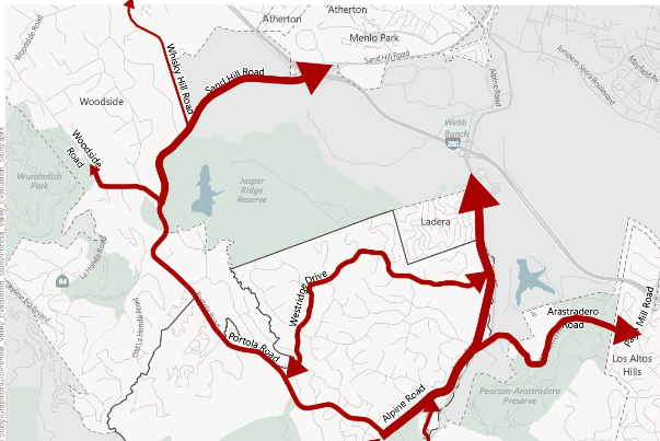
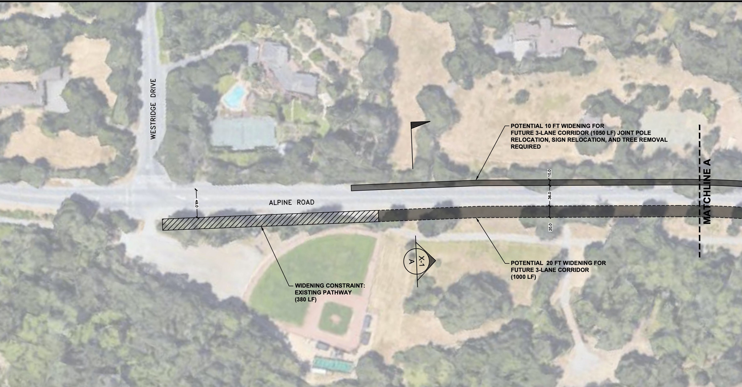
The report, which the Town Council approved a draft of on Aug. 10, found several strategies for reducing travel times out of town. Options include wildfire video surveillance cameras or drones to quickly detect wildfires and constructing an evacuation lane on the shoulder of the the eastern side of the Westridge and Alpine roads through Ladera. They also surveyed stables to gauge the number of horses and trailers in Portola Valley and the surrounding community.
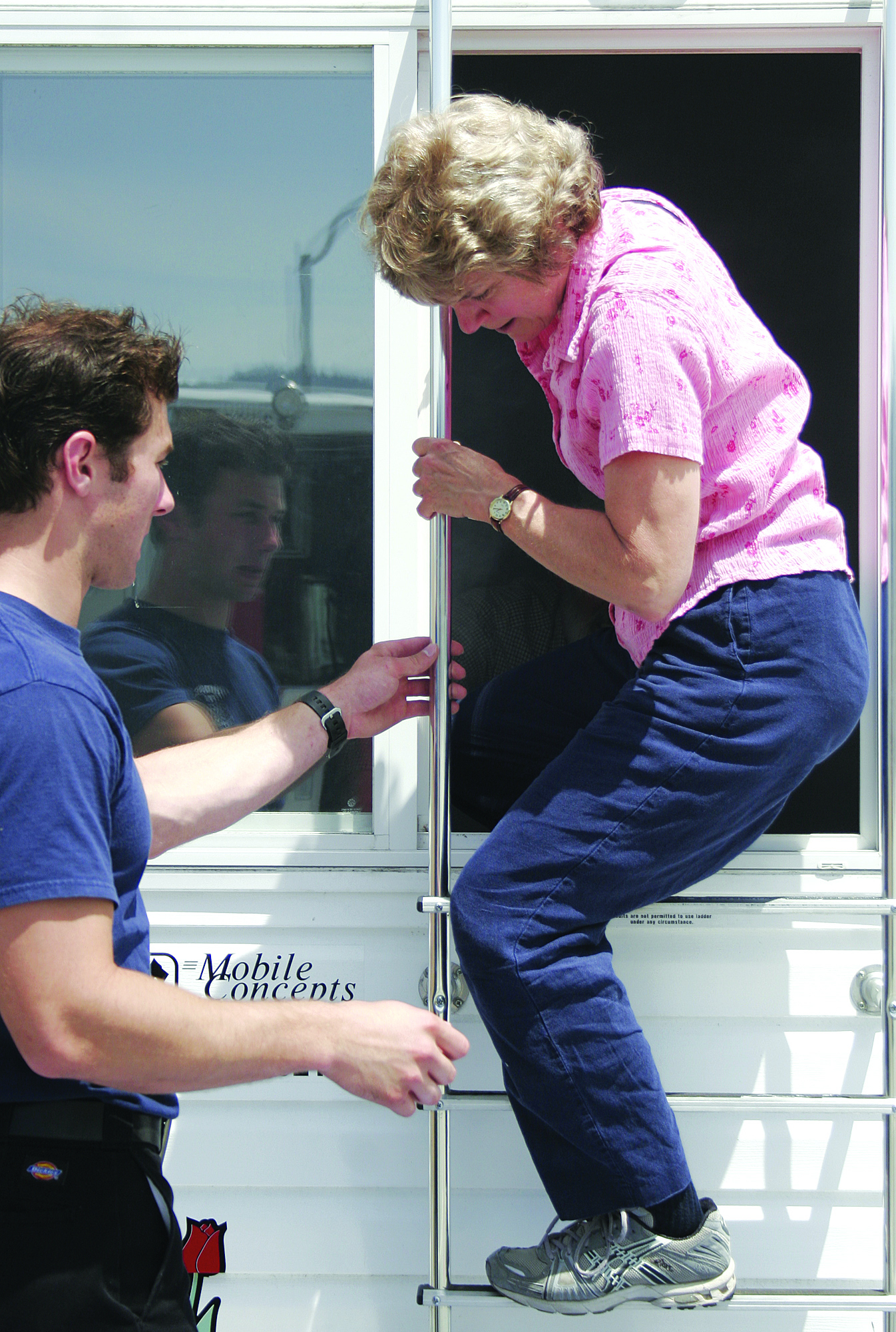
Emergency evacuation is top of mind for some residents who staged their own ad-hoc evacuation drill last summer after town officials said such an exercise wasn't worthwhile. Town and San Mateo County officials say such small-scale events aren't useful, preferring to use modeling instead.
Once complete, the study will be incorporated in the town's safety element update, which is happening in tandem with its housing element.
Fehr & Peers, which conducted the 10-month long study, did a similar study in Rancho Cucamonga in Southern California. The firm is now working on another evacuation study in Marin County.
Worst-case scenarios studied
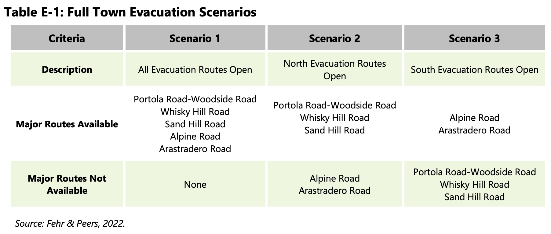
The study outlines three evacuation scenarios. Each are premised on worst-case scenario conditions to understand how long an evacuation may take: A 6 a.m. evacuation order; all residents in the affected area (Portola Valley, Los Trancos Woods/Vista Verde, Ladera, Farm Road, Old La Honda and Old Alpine areas) are at home and evacuate; and 1.9 trips per household.
Consultant Bob Grandy said early morning evacuations are common for fires that start overnight and that most residents will be home at 6 a.m.
The study also includes 396 employees in town, 100 horse trailer trips (the equivalent of 300 passenger car trips) and the fact that 85% of residents in the affected areas listed above are assumed to begin their trip within an hour of the evacuation order.
The three scenarios and their findings were:
• All routes are open. Under this scenario, 90% of residents are expected to have evacuated by between 1 hour 15 minutes to 1 hour 30 minutes, with 100% having evacuated by between 3 hours to 3 hours 15 minutes.
• Alpine and Arastradero Roads are closed. Under this scenario, 90% of residents are expected to take between 2 hours 45 minutes and 3 hours 45 minutes to evacuate, with 100% having evacuated by between 3 hours 30 minutes and 4 hours 45 minutes.
• Portola, Woodside, Whiskey Hill and Sand Hill Roads are closed. In this scenario, some 90% of residents are expected to take between 2 hours and 2 hours 45 minutes to evacuate, with 100% by between 3 hours 15 minutes and 3 hours 30 minutes.
Consultants plan to work with schools in town to gather more information for the study per the Town Council's request.
Calls for more comprehensive study, suggestions
Some residents said they want to see a more comprehensive evacuation study.
Rita Comes, president of Portola Valley Neighbors United, a group focused on fire and seismic safety, affordable housing, and natural habitat," questioned the 6 a.m. evacuation order time. She also said the study should incorporate other risks such as earthquakes, terrorist attacks, landslides and more, not just wildfire threat.
"Not much movement in town at that time except (for) all of the construction trucks that come into town from other locations," she said in a note to the town. "We don't need an easy 'evacuation study' to check a box, we need a survival plan so that people can feel that they can get out and keep their families safe. No one plan is going to do everything but the proposed plan that the residents are paying for should reflect how we actually live everyday in our beautiful town."
She also lists several outstanding questions she was left with after reading the study, such as how adding 253 housing units over the next eight years, as the town is mandated to plan for by the state, would impact an evacuation.
Resident Dave Cardinal suggested the town explore an escape route through Webb Ranch, which is owned by Stanford University.
"If they (residents in the Webb Ranch area) had a back door, that would be amazing," he said during the Aug. 10 meeting.
Kristi Corley suggested during the meeting that Monday would be a bad day to take car circulation reports since the town's busiest entities — the Alpine Inn, Alpine Hills Tennis and Swimming Club and Parkside Grille — are closed on Mondays.
Victor Schachter said training residents to conduct traffic control during an evacuation would be a good idea, although he noted there is skepticism from police officers about this approach.
Strategies for improving evacuations
Consultants suggested realigning portions of Alpine Road and redesigning the Alpine Road Trail in certain locations.
The town could explore escape routes on Stanford University-owned lands to the north of Portola Valley, such as upper Los Trancos Road and upper Alpine Road.
The town could also install vehicle monitoring devices and message signs to monitor evacuation progress and to notify drivers of any changes in evacuation routes or plans because of a change in the wildfire or incident.
The town safety element is expected to be presented to the Town Council for final review in the late fall of 2022, according to the town website.
View the study here.
Comments
Registered user
another community
on Aug 19, 2022 at 1:18 pm
Registered user
on Aug 19, 2022 at 1:18 pm
The PVNU broken record continues:
Town: "We're studying fire safety"
PVNU: "That's not good enough, you need to study fire egress because new housing development in town will make us unsafe"
Town: "OK, here's a professional study of fire egress by experts"
PVNU "That's not good enough, you also need to study earthquakes and terrorist attacks [seriously??] because new housing development in town will make us unsafe".
I believe (prove me wrong) that PVNU only exists to block any and all new housing in PV, and they'll keep throwing every argument they can at the wall until they win.
I am so tired of this...
Registered user
Portola Valley: Brookside Park
on Aug 20, 2022 at 12:57 pm
Registered user
on Aug 20, 2022 at 12:57 pm
If both Alpine and Portola Roads are blocked there need to be ways up Windy Hill, for example, through Fogarty Winery, through Pony Tracks Ranch to Page Mill Road. Even though flames move uphill, going up maybe the only way out could be uphill.
Registered user
Menlo Park: Park Forest
on Aug 22, 2022 at 2:54 am
Registered user
on Aug 22, 2022 at 2:54 am
Here is a good model of an evacuation plan from a road constrained neighborhood:
Web Link