


A naturally curious person with an engineering background, Portola Valley resident Dave Cardinal decided to start tinkering with solving a question of concern to some residents: What would it look like should the town have to evacuate during an emergency?
Cardinal, who teaches engineering courses at Stanford University, began creating a traffic simulation back in the spring. In addition to a situation like a major fire, he wondered how more people moving to town through housing projects like the Stanford Wedge proposal and the 253 housing units the town must designate for in its upcoming housing element could impact an evacuation.
"I started modeling and I got carried away," Cardinal said of the "hobby project" he's been doing for free. "I was interested partially because from the planning point of view, I wanted to know, 'What difference it makes to put more families in town and does it matter where they are?'"
Cardinal, who lives in the Alpine Hills neighborhood, created his own tool when he found other small scale emergency evacuation models were few and far between most look at larger scale events, like how to evacuate an entire state during a hurricane. There have been research studies completed on the 2018 Paradise fire, but those models looked backward rather than forward. He wants Woodside Fire Protection District, the San Mateo County Sheriff's Office and town officials to have a tool they can use to run scenarios and decide how to respond.
Town consultants are in the midst of an evacuation study, which they launched in September. Town staff plan to have Cardinal work with consultants who are analyzing different scenarios that may affect evacuations and suggest whether improvements to Portola Valley's infrastructure may be beneficial, according to the town. A report is expected to be completed in February, said Town Manager Jeremy Dennis.
He put in the number of potential residents that could be added to town based on 2023-31 Regional Housing Needs Allocation numbers to see how evacuations might look with a larger population.
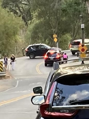
Neighbors held their own evacuation drill in August, which Cardinal said was helpful for his modeling. The data he uses for the model is based on OpenStreetMap, an editable geographic database, or Google Maps. The maps don't show "the pavement is only 8 feet wide here" or "there's room for another lane here." The simulation doesn't take into account if a road is closed or a car breaks down and blocks traffic, which the drill does, he explained.
But overall, only a few hundred people participate in such drills at a time and it only simulates one question. With a simulation model, you can do much more, he said.
The simulation
The Almanac viewed a demo of Cardinal's technology, which has not yet been released to the public.
Cardinal said he sought to create a model that includes people, cars and road externalities. He fed the model information on the projected fire spread.
He pulled data from OpenStreetMap, which he said came with a lot of issues he needed to fix, including data that comes in a "zillion" formats.
He wanted to simulate what happens with a variety of complications (such as road closures and traffic from other areas) and mitigations (making roads one way, adding traffic control at key points).
Models generally include a limited amount of local knowledge, he said. They tend to rely on speed limits and theoretical maximums, not an awareness of how the roads actually work. There's also limited flexibility for "outliers" like horse farms or homes with trailered vehicles.
Major takeaways
The town would "overall be in good shape" during an evacuation, Cardinal said, based on his models. It would take between two to four hours after an evacuation order is given, according to his simulation. Major factors include:
• How many people would have already left, assuming there was a prior warning
• How many cars each family takes
• How long it takes people to pack up and start out
• What complications occur (downed lines, accidents, roads closed, etc.)
If more residents move into town, for evacuation purposes, it'd be best for them to live near exits in town. Stanford University's proposed Wedge project is located just south of Interstate 280 on Alpine Road. There could be up to 7,500 cars that leave Portola Valley during an evacuation, but realistically residents are not all going to leave at the same time, he said.
The project, called Portola Terrace, includes 39 housing units on part of the property's 75 acres located between Westridge and Golden Oak drives. It was initially proposed over two years ago, and some residents have cited potential traffic jams and fire hazards for opposing the development plans.
"People make it seem like (if we build) the Wedge project will suddenly make it so we're all going to die in flames or something," he said.
With about 200 additional housing units, mostly accessory dwelling units, spread all over town, residents should be able to leave fairly easily in a normal evacuation scenario.
His simulation shows police intervention will be "really important."
"Some intersections are particularly tricky," he said. "The (town) traffic plan has traffic control points and expect they can do that (in an evacuation)."
Cardinal said the biggest surprise from the model is that if you make Arastradero Road one way for outbound traffic, on paper it serves as a decent third alternative route.
"I'm hoping this is a place where the traffic engineers can help us decide if that's realistic," he said.
There's no way to exit to a main roadway from the town to the west and that can't be fixed, he noted. If there's a fire along the 280 corridor, then residents might have to shelter somewhere like Corte Madera School, near the Frog Pond.
He also noted it would be ideal if there was another way to get out of the Ladera neighborhood.
He said Portola Valley residents are rightly worried about fire risk and losing their home insurance policies, a trend in recent years.
"Some level of fear makes sense," he said. "I do think a lot of people are very sincere. I think some other people just want to leave things the way they are. The world moves. Stanford owns 75 acres and it's their land. It's America, you get to do stuff with your property."
He also argues Stanford will maintain the property better against fire risk with faculty members living on it.
Some residents have said Portola Valley could face a catastrophic fire similar to the 2018 Camp Fire that devastated the town of Paradise, but Cardinal argues that conditions are not the same. Paradise had a larger population (almost 27,000 versus fewer than 5,000 in Portola Valley) and downslope winds in the dry season. Portola Valley is close to a major highway that can bring residents to nearby cities, unlike Paradise. There are also no traffic lights in Portola Valley that would require synchronization.
"You could walk out of here (Portola Valley) or mountain bike out of here; you'll get to 280 almost no matter what," he said. "But you never know what's going to happen next."
He noted that his model doesn't take into account that evacuating through I-280 is dependent on regions. For example, traffic from San Francisco to the Peninsula will clog the highway, so ultimately the model needs to be on a larger scale, he said.
For more on the town's traffic study, go here.
Comments